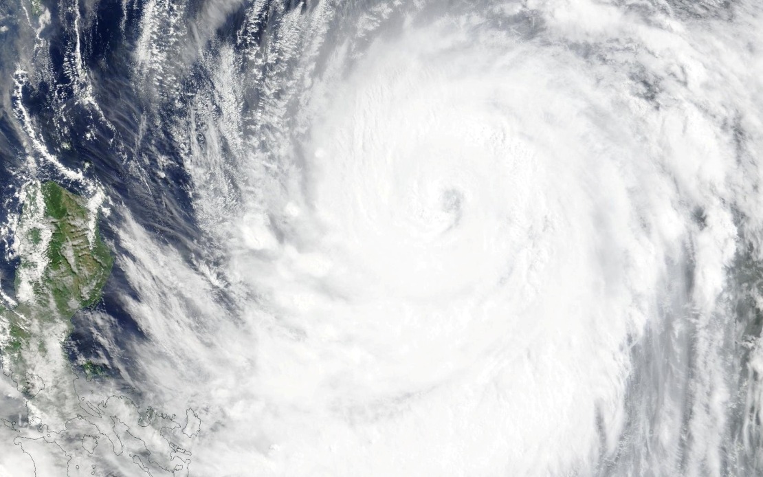
Taiwan's meteorological authority escalated its alert status on Thursday afternoon as Typhoon Bavi intensified and advanced toward the island nation, with officials preparing residents for potential impact by Friday morning. The decision to issue a formal sea warning underscores growing concern about the storm's trajectory and strengthening winds, which could bring significant disruption across the region and affect shipping lanes and air routes that connect Taiwan to neighbouring territories.
The sea warning, announced at 2:30 pm local time, encompasses strategically important maritime zones surrounding Taiwan's coastline. The alert encompasses waters off the northeastern and southeastern portions of the island, extending to include Orchid Island and Green Island—both inhabited territories vulnerable to tropical storm conditions. The Bashi Channel, a critical waterway separating Taiwan from the Philippines and used extensively by regional shipping traffic, has also been flagged as a zone of concern, alerting mariners to exercise heightened caution.
Meteorological data placed Bavi in the waters southeast of Eluanbi, Taiwan's southernmost geographic point, while the system continued its northwest movement across the western Pacific. This positioning indicated that the typhoon was gradually approaching the island rather than tracking away, a trajectory that informed official decisions to escalate warning levels and prepare for potential landfall or close passage. The storm's location relative to Taiwan's geography meant that northeastern and southeastern regions would likely experience the most severe conditions, though island-wide preparations were being advised.
The physical intensity of Typhoon Bavi presented a formidable meteorological challenge. Maximum sustained winds near the storm's core had reached 51 metres per second, equivalent to approximately 184 kilometres per hour, while gusts in the immediate vicinity of the centre were projected to achieve 63 metres per second or roughly 227 kilometres per hour. Such wind speeds place the system firmly in the upper range of tropical cyclone strength, capable of causing structural damage and presenting serious hazards to outdoor activities and exposed infrastructure.
Forecasters anticipated that Bavi would maintain its northwest course at a forward speed of 15 to 20 kilometres per hour, a relatively steady progression that would bring it to pass across or north of Taiwan's territory. The projected impact classification suggested the island would experience either the lower end of strong typhoon conditions or the upper boundary of moderate typhoon strength, depending on the precise track and any weakening that might occur before arrival. This range of outcomes meant that preparations had to account for a spectrum of possible damage scenarios, from severe wind damage to moderate infrastructure disruption.
The approaching storm had already begun affecting the broader regional transport infrastructure even before making direct contact with Taiwan. Airlines operating services between Taiwan and Okinawa, Japan—a key route for both leisure and business travellers in East Asia—cancelled the majority of scheduled flights as a precautionary measure. Several long-haul international services operating from Taiwan's major airports were also disrupted, reflecting the wide geographic reach of operational concerns associated with the approaching system. Such cancellations typically result in significant economic losses for carriers and inconvenience for thousands of passengers.
Maritime transportation networks similarly faced disruption as authorities suspended multiple ferry routes connecting Taiwan to outlying islands and possibly to regional destinations. The suspension of ferry services, which carry both passengers and cargo, represented a precautionary step to prevent vessels from being caught in dangerous seas generated by the typhoon. For residents of Taiwan's offshore islands, such suspensions can create supply chain challenges and isolate communities temporarily from mainland connections.
Terrestrial transportation infrastructure also came under heightened alert status as authorities flagged mountain roads throughout Taiwan for potential hazardous conditions. Such roads, which traverse Taiwan's dramatic central mountain range, are particularly vulnerable to typhoon-induced landslides, flooding, and debris flows. By placing these routes on alert before conditions deteriorated, authorities aimed to encourage early closure decisions and prevent motorists from becoming stranded or endangered by rapidly developing hazards.
The timing of Bavi's approach during the summer season added complexity to preparation efforts, as the period typically sees elevated tourist activity across Taiwan and the broader region. Authorities would need to balance warnings and precautions with efforts to minimise panic while ensuring that both residents and visitors took appropriate shelter and safety measures. The convergence of tourism patterns with severe weather represents an ongoing challenge for Taiwan's disaster management framework.
For Malaysia and other Southeast Asian nations, Typhoon Bavi's development carried secondary implications. The storm's track and intensity could influence weather patterns across the broader region, potentially steering moisture systems toward Southeast Asian shores. Understanding the behaviour of major typhoons affecting Taiwan provides valuable meteorological intelligence for regional forecasting and disaster preparedness, as these systems sometimes influence monsoon dynamics and regional rainfall patterns that affect agricultural planning and water resource management across the region.

