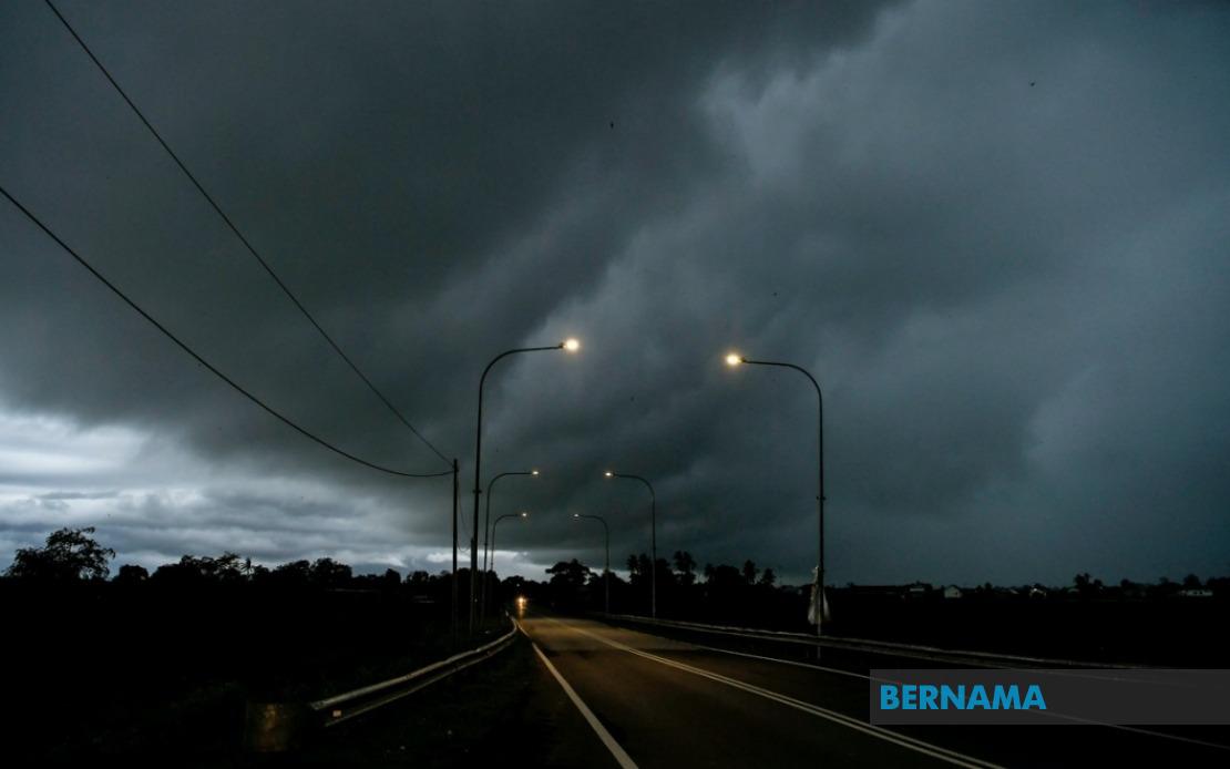
Malaysia's Meteorological Department has sounded an alert for severe weather conditions across six states and the federal territory of Labuan, with forecasters cautioning residents to prepare for thunderstorms accompanied by heavy rainfall and gusty winds until 1 am on June 19. The warning, issued on June 18, covers a geographically dispersed range of districts extending from the northwest peninsula through the east coast and into Borneo, reflecting the unpredictable nature of convective weather patterns during the inter-monsoon period.
On the Malay Peninsula, the alert encompasses several districts in Kedah, specifically Padang Terap, Sik and Baling in the state's interior and northern reaches. The neighbouring state of Perak is similarly affected, with MetMalaysia flagging Hulu Perak as a zone of concern. The east coast region faces heightened risk across a substantial portion of Kelantan, including the districts of Tumpat, Pasir Mas, Jeli, Tanah Merah and Kuala Krai, reflecting the monsoon system's traditional tendency to generate atmospheric instability in that corridor. Pahang's Jerantut district has also been placed under the warning.
The scope of the meteorological alert extends considerably into Sarawak, demonstrating how weather systems across the South China Sea can impact large swathes of East Malaysia. The affected areas span from coastal Kuching, Serian and Samarahan through the riverine districts of Sri Aman, where preliminary weather deterioration often signals broader regional instability. The division extends to include parts of Betong in the southwest, the Sarikei region encompassing Julau, and the Sibu division including Kanowit and Selangau. The alert further encompasses Kapit and its surrounding regions, including Bukit Mabong, the coastal development zone of Bintulu, and the northern regions of Miri, where Subis, Beluru, Miri town itself and Marudi face the warning. Limbang district completes the Sarawak coverage.
In Sabah, the warning applies to selected interior and coastal areas, reflecting the archipelagic state's varied topography and exposure to multiple weather systems. The affected zones include Kuala Penyu in the interior region, while the West Coast division experiences alerts covering Putatan and Ranau. The eastern Sandakan division is similarly impacted, with Telupid and Beluran named as specific areas of concern. The federal territory of Labuan, positioned strategically off Sabah's coast and serving as an important maritime and commercial hub, has also been included in the alert.
Thunderstorm warnings of this geographic breadth typically occur during transitional monsoon periods when competing air masses create atmospheric conditions conducive to rapid convection and heavy precipitation. The combination of thunderstorms, strong winds and torrential rain presents multiple hazards to communities and infrastructure. Residents in affected areas should exercise caution regarding flash flooding in low-lying zones, potential disruptions to transportation networks, and possible localized power outages resulting from wind damage or lightning strikes affecting electrical systems.
For maritime stakeholders, including fishing communities operating from ports in the affected regions and commercial shipping transiting through Malaysian waters, the warning carries significant implications. Sudden squalls and reduced visibility associated with thunderstorms can pose substantial safety risks to vessels at sea. Operators are typically advised to secure additional precautions, seek shelter where possible, or delay departures until atmospheric conditions stabilize.
The timing of this alert—extending through the early morning hours—suggests MetMalaysia's assessment that the convective activity will persist through the night rather than dissipating in the evening as sometimes occurs. This extended timeline increases the cumulative rainfall potential and the likelihood of weather-related incidents affecting overnight activities and early-morning commutes in the warned districts.
The dispersed geographic pattern of this warning, spanning multiple states and territories with considerable distances between some alert zones, underscores the complexity of tropical weather systems in the maritime Southeast Asian context. While individual thunderstorm cells typically affect limited areas, the underlying atmospheric conditions triggering such widespread alerts indicate a regional-scale influence—possibly related to a broader pressure system or the interaction of localized convection with larger-scale moisture patterns.
Residents and businesses in the specified areas are advised to monitor subsequent updates from MetMalaysia, as the meteorological department typically refines forecasts as new observational data becomes available. Early warning systems and community preparedness remain critical in regions prone to sudden weather deterioration, particularly given the potential for thunderstorm-related hazards to develop rapidly.


%22%2F%3E%3C%2Fpattern%3E%3C%2Fdefs%3E%3Crect%20width%3D%22100%25%22%20height%3D%22100%25%22%20fill%3D%22url(%23ph2dfp0g)%22%2F%3E%3Crect%20width%3D%22100%25%22%20height%3D%22100%25%22%20fill%3D%22url(%23ph2dfp0p)%22%2F%3E%3Ctext%20x%3D%2250%25%22%20y%3D%2250%25%22%20text-anchor%3D%22middle%22%20dominant-baseline%3D%22central%22%20fill%3D%22rgba(255%2C255%2C255%2C0.95)%22%20font-family%3D%22Georgia%2C%20'Times%20New%20Roman'%2C%20serif%22%20font-weight%3D%22700%22%20font-size%3D%22272%22%20letter-spacing%3D%22-0.02em%22%3EPerak%3C%2Ftext%3E%3C%2Fsvg%3E)