South Korea is proceeding with its fourth medium-sized Earth observation satellite, lifting off from Vandenberg Space Force Base in California aboard a SpaceX Falcon 9 rocket on Tuesday. The Korea AeroSpace Administration confirmed the 500-kilogramme spacecraft will depart at 4.10 pm Korea time, marking another milestone in Seoul's expanding capability to monitor the Korean Peninsula and surrounding regions independently. The decision to use commercial space infrastructure reflects a broader regional trend among East Asian nations seeking cost-effective access to orbit while advancing domestic space technology.
The satellite has completed all required functional testing and fuel loading procedures over the preceding month, positioning it for immediate deployment once clearance is granted. Following its ascent, the spacecraft will separate from the launcher roughly two hours and twenty-two minutes after ignition, establishing communication through the Svalbard ground station located in Norway approximately thirty-one minutes after that separation event. This communication architecture demonstrates the international cooperation inherent in modern space operations, with Norway serving as a vital gateway for Asian satellite networks.
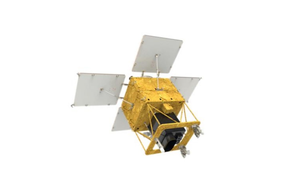
The payload configuration reflects South Korea's emphasis on indigenous technological development. Onboard systems include locally manufactured observation equipment designed to capture high-resolution imagery of the entire Korean Peninsula on a three-day revisit cycle. This capability ensures regular monitoring without dependence on foreign satellite data, a strategic advantage for national security and resource management. The frequency of coverage represents a significant improvement over traditional Earth observation systems, enabling responsive tracking of environmental and infrastructure changes.
Government planners envision applications extending across multiple sectors beyond traditional defense considerations. Agricultural productivity mapping will allow farmers and policymakers to monitor crop health and optimize resource allocation across South Korea's limited arable land. Forestry management becomes more data-driven, with satellite imagery supporting sustainable timber harvesting and reforestation efforts. The system will enhance disaster response capabilities by providing rapid post-incident imaging of affected areas, accelerating rescue and recovery operations during floods, earthquakes, or other emergencies.
Climate change analysis represents an increasingly critical application, as South Korea confronts rising sea levels and shifting precipitation patterns that threaten coastal communities and agricultural zones. The satellite's capacity to track environmental trends over extended periods will inform long-term adaptation strategies. Public safety enhancement spans crowd management at major events, infrastructure inspection for maintenance planning, and urban development monitoring. These multifaceted uses demonstrate how space technology extends beyond traditional remote sensing into broader societal benefit.
The operational timeline includes a four-month commissioning phase once the satellite reaches its designated orbit approximately 888 kilometres above Earth's surface. During this validation period, engineers will systematically test all systems, calibrate imaging equipment, and verify data transmission quality. Full operational deployment is targeted for the first half of next year, at which point the constellation will begin delivering regular intelligence products to authorized government agencies and authorized civilian users.
This launch positions South Korea as a significant player in Asia-Pacific space capabilities, joining Japan, China, and India in operating advanced Earth observation systems. The regional implications are substantial, as more nations achieve independent monitoring capacity, reducing reliance on external providers and enhancing data security. For Malaysia and Southeast Asia more broadly, the expanding availability of satellite imagery from South Korean sources offers potential opportunities for collaborative environmental monitoring, disaster management coordination, and agricultural development support through bilateral partnerships or multilateral frameworks.
The commercial partnership with SpaceX reflects Seoul's pragmatic approach to launch infrastructure. Rather than developing expensive indigenous heavy-lift capabilities, South Korea leverages proven international providers while concentrating resources on payload development and data application systems. This strategy has proven cost-effective across multiple nations pursuing space programs with constrained budgets. The approach also enables more frequent launch scheduling without waiting periods that domestic systems might impose.
The fourth satellite completes an initial constellation phase, establishing redundancy and improved coverage reliability. Additional launches are anticipated as South Korea expands its Earth observation network to meet growing demand from multiple government departments and potential commercial users. The precedent established through these deployments may encourage technology transfer and joint ventures with partners in Southeast Asia seeking similar capabilities for regional applications.
Southeast Asian nations, including Malaysia, should monitor this development trajectory as a model for cost-effective space infrastructure development. The combination of domestically manufactured payloads with commercial launch services offers a pathway for developing nations to establish space-based monitoring capabilities without unprecedented investment levels. South Korea's experience demonstrates that technological sophistication in satellite systems can be achieved through focused engineering investment even without independent launch vehicle development, potentially informing regional space strategies.