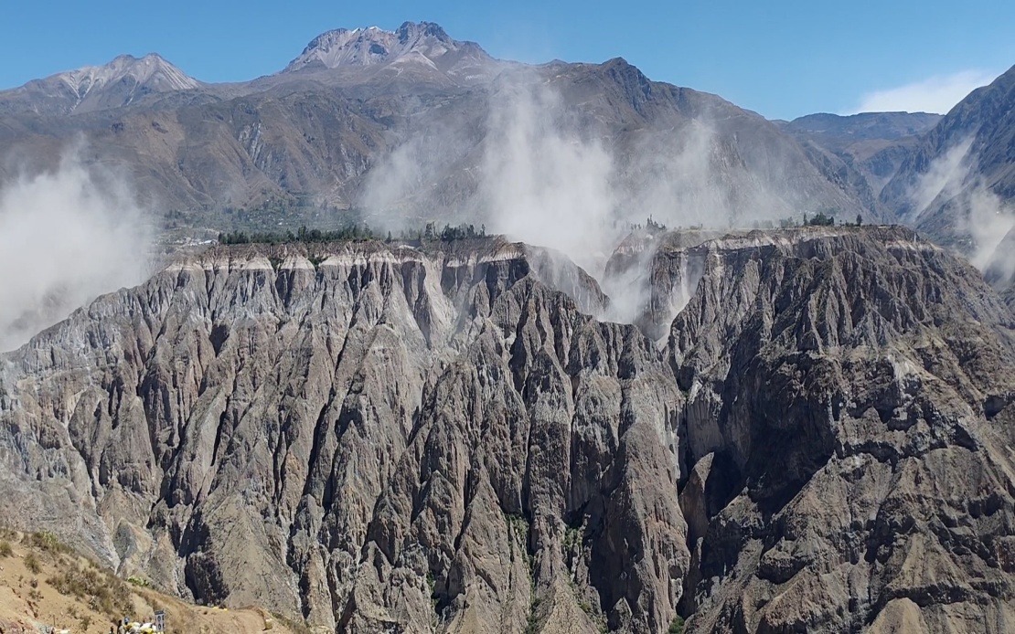
A formidable earthquake measuring 6.7 on the Richter scale jolted southern Peru on Thursday afternoon, prompting heightened alerts across the nation and drawing attention to the country's ongoing seismic vulnerability. The US Geological Survey registered the event, while Peru's Geophysical Institute (IGP) documented the tremor at slightly higher magnitude, recording 7.2 at 1 pm local time. The epicentre positioned itself approximately 35 kilometres north of Coracora in Parinacochas province within the Ayacucho department, at an intermediate depth of 108 kilometres below the surface.
The considerable depth of the earthquake's origin played a crucial role in mitigating surface-level destruction. Seismic experts explained that the 108-kilometre depth allowed the released energy to dissipate substantially before reaching populated areas, resulting in light to moderate shaking classified as III-IV on the Mercalli intensity scale near the epicentre. This protective buffer explained why initial assessments from Peruvian disaster management authorities and emergency response agencies found no reported fatalities or significant property destruction despite the tremor's considerable magnitude.
The seismic disturbance radiated across vast distances, with residents throughout southern and central Peru clearly sensing the ground movement. In Lima, the nation's sprawling capital located hundreds of kilometres from the epicentre, inhabitants also experienced noticeable shaking, demonstrating the earthquake's substantial reach and the interconnected nature of Peru's tectonic environment. This widespread perception underscored the geological reality that major seismic events in Peru possess the capacity to affect populations across multiple regions simultaneously.
This recent incident arrives amid an extended period of elevated seismic activity concentrated in Peru's northern and southern zones. Geologists monitoring the region have noted recurring tremors signalling persistent tectonic stress along the western coast and interior highlands. The pattern reflects Peru's precarious geological positioning and the constant pressure exerted by the movement of major crustal plates underlying the nation.
Peru's susceptibility to frequent and powerful earthquakes stems directly from its location astride the Pacific Ring of Fire, a semi-circular belt encompassing the Pacific Ocean's perimeter where approximately 90 per cent of the world's earthquake activity occurs. This geographic reality makes seismic preparedness not merely advisable but essential for Peruvian communities. Historical precedent demonstrates the catastrophic potential residing within Peru's geological structure. In 2007, a 7.9 magnitude earthquake centred in the Ica region devastated surrounding areas and claimed approximately 600 lives, illustrating the deadly consequences when major tremors strike populated zones.
In response to both this week's earthquake and the broader pattern of recent seismic activity, the IGP's National Seismological Centre (CENSIS) released formal guidance directing the public toward proactive safety measures. Authorities emphasised the importance of reviewing and practising household evacuation plans, ensuring family members understood designated meeting points and escape routes. Additionally, officials recommended maintaining well-stocked emergency supply kits containing essentials such as water, non-perishable food, first aid materials, and communication devices.
The institutional response reflects a measured approach balancing public reassurance with honest acknowledgement of seismic risks. While this particular earthquake caused no immediate harm, Peruvian authorities recognised the episode as a reminder of underlying vulnerability. The recommendation to maintain vigilance and preparedness represents standard disaster management protocol in a nation where earthquakes constitute a persistent natural hazard rather than an exceptional occurrence.
For Southeast Asian readers, Peru's earthquake activity offers relevant comparative lessons. The region shares similar tectonic characteristics with parts of Southeast Asia, particularly the Sunda subduction zone extending through Indonesia and the fault systems intersecting the Philippines. Both Peru and several Southeast Asian nations experience frequent seismic activity and maintain ongoing challenges in earthquake preparedness. The effectiveness of Peru's response—rapid assessment, clear communication, and emphasis on individual household preparedness—provides a model applicable across the Pacific and Indian Ocean regions where communities face comparable geological hazards.
The distinction between magnitude and impact evident in Thursday's earthquake also illuminates an important scientific reality often misunderstood by general publics. The difference between a 6.7 and 7.2 magnitude measurement involves exponentially greater energy release, yet depth, geology, and population distribution determine actual destruction. Peru's experience suggests that nations with substantial seismic exposure must invest in both advanced monitoring infrastructure and comprehensive public education programmes that help residents understand earthquake dynamics beyond simple magnitude reporting.
Looking forward, Peru's earthquake monitoring agencies will likely maintain intensified observational protocols across known seismic zones. The proximity of this week's tremor to previous activity areas suggests continued geological stress requiring sustained scientific attention. International collaboration through organisations monitoring the Ring of Fire enhances predictive capability, though earthquake prediction remains scientifically elusive. What remains achievable and essential involves improving early warning systems, strengthening building codes, and fostering cultural understanding of earthquake preparedness as an integral component of living in tectonically active regions.

