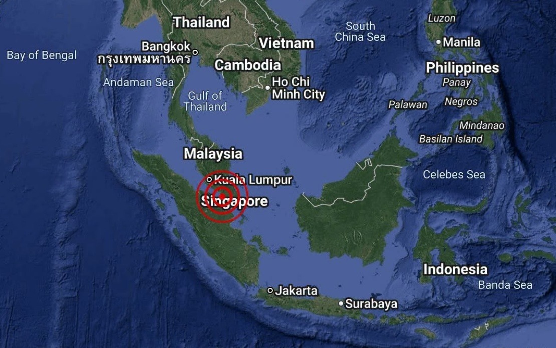
A minor seismic event measuring 3.1 on the Richter scale occurred in the waters southwest of Batu Pahat in Johor on Monday afternoon, according to the Malaysian Meteorological Department. The tremor struck at 4.12 pm with its epicentre positioned at coordinates 1.7 degrees north and 102.8 degrees east, approximately 18 kilometres from the district's coastline.
The National Weather and Earthquake Operations Centre, operating under MetMalaysia, issued a statement confirming the incident and providing preliminary seismic data. While the agency's release was brief, officials moved quickly to assess the event and its potential implications for coastal areas and maritime activity in the region.
Malaysia's seismic monitoring infrastructure regularly tracks underground movements across the peninsula and surrounding waters. The country's geological position within the Ring of Fire and proximity to major fault lines means that tremors, though typically minor, warrant systematic documentation and public communication. Monday's earthquake represents a routine monitoring event for the nation's earthquake surveillance network.
MetMalaysia's statement explicitly addressed public safety concerns by ruling out any tsunami risk to Malaysian shores following the event. This reassurance is particularly important given the nation's experience with devastating tsunamis in the past and the public's heightened awareness of seismic hazards in Southeast Asia. The rapid dissemination of this information serves to prevent unnecessary alarm and maintain public confidence in official monitoring systems.
Batu Pahat, situated on Johor's southwestern coast, experiences occasional seismic activity due to its proximity to various tectonic features beneath the Strait of Malacca and the South China Sea. The district's maritime economy, including fishing operations and shipping lanes, depends on reliable geophysical monitoring to ensure safety and continuity of activities.
The 3.1-magnitude classification places this event firmly in the weak category—typically imperceptible to human observers on land and unlikely to cause any structural damage. Most earthquakes in this range go unnoticed by the general population, though sensitive instruments at monitoring stations detect them routinely. This particular event's offshore location further reduced any potential impact on populated areas.
Regional earthquake monitoring serves broader functions beyond immediate disaster prevention. Data collected from events like Monday's tremor contribute to scientific understanding of Malaysia's geological composition and tectonic dynamics. Researchers at MetMalaysia and academic institutions use accumulated seismic records to map fault systems, assess long-term hazard patterns, and refine early warning capabilities.
The Malaysian government maintains several earthquake monitoring stations distributed across the peninsula and Sabah and Sarawak to ensure comprehensive coverage of seismic activity nationwide. These facilities operate continuously, recording thousands of minor events annually that never reach public attention. The monitoring network represents a crucial component of the nation's disaster risk reduction infrastructure, working alongside tsunami detection systems and other early warning mechanisms.
For residents and businesses in Batu Pahat and neighbouring areas, Monday's incident passed with minimal disruption. The offshore epicentre, combined with the earthquake's weak magnitude, meant that no evacuation procedures or emergency protocols were triggered. Routine activity in the district continued uninterrupted following the seismic event.
The incident underscores the importance of maintaining robust geophysical monitoring systems across Southeast Asia. Malaysia's participation in regional earthquake surveillance networks enhances understanding of seismic patterns affecting the broader region, where multiple countries share interconnected geological systems. Information sharing between national meteorological agencies strengthens collective disaster preparedness.
Looking forward, Malaysia's continued investment in earthquake detection technology and personnel training remains essential for protecting the nation's 34 million residents and vital infrastructure. As urbanisation accelerates and populations concentrate in coastal zones, the ability to quickly assess seismic events and communicate findings accurately becomes increasingly valuable for public safety and economic continuity.

