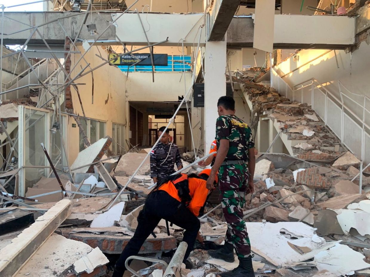
A powerful magnitude 7.7 earthquake jolted Indonesia's Flores region in the early hours of Saturday, August 15, leaving collapsed buildings and homes in its wake and claiming at least two lives. The tremor struck with enough force to trigger immediate panic across the affected area, a region acutely familiar with seismic hazards and their devastating consequences. Preliminary reports from local rescue operations detailed two confirmed fatalities and two injured individuals, with significant structural damage reported across multiple sites.
The epicenter was located 68 kilometres north-northwest of the city of Ende in East Nusa Tenggara province, according to data from the U.S. Geological Survey. The quake occurred at a depth of 10 kilometres at 5:58 a.m. local time, positioning it as a shallow undersea event that transmitted its energy efficiently to surrounding land masses. Multiple aftershocks followed the initial tremor, adding to the sense of vulnerability among residents already shaken by the main event.
Indonesian authorities responded swiftly by issuing a tsunami warning for affected provinces including parts of East Nusa Tenggara, West Nusa Tenggara, South Sulawesi and Southeast Sulawesi. Residents were instructed to vacate beaches and riverbanks immediately and move inland to higher elevations. However, the warning was subsequently lifted after the country's Meteorology, Climatology and Geophysics Agency determined through careful monitoring that no significant sea-level changes were occurring that would pose a genuine threat to coastal populations. This assessment provided some relief to communities already grappling with the earthquake's immediate aftermath.
Television footage captured the scene of emergency response efforts in the hours following the quake, showing hospital staff evacuating patients from damaged buildings as a precaution. Medical workers improvised by relocating equipment and establishing temporary treatment areas in open spaces, moving beds, intravenous stands and oxygen cylinders outside to maintain emergency operations. The rapid evacuation of health facilities underscored both the severity of structural damage and the professionalism of response teams operating under challenging circumstances.
Eye-witness accounts from residents provided vivid details of the destruction. Yohanna Embu, a resident of Sikka regency, described widespread building damage across her community and recounted how frightened residents instinctively sought higher ground. She specifically noted the collapse of the waiting area at Maumere's port terminal, highlighting how the earthquake damaged infrastructure across multiple sectors and locations. These accounts painted a picture of a community subjected to considerable physical trauma.
The earthquake's impact extended to religious institutions on the predominantly Catholic island. Students and nuns at St. Peter Major Seminary in Sikka, locally known as Ritapiret Seminary, were attending morning Mass when the roof of an assembly hall collapsed, sending worshippers fleeing in panic. Rev. Guidelbertus Tanga, the seminary's rector, reported that at least one priest sustained a broken leg after jumping from the second floor of a building during the violent shaking. Such injuries highlighted the extreme conditions people faced as they fled collapsing structures.
Indonesia's vulnerability to powerful seismic events stems from its geographical position within the Pacific Ring of Fire, an extensive arc of volcanoes and fault lines encircling the Pacific Basin. As a vast archipelago comprising more than 17,000 islands, the nation sits atop multiple tectonic plate boundaries where complex geological interactions generate regular earthquake activity. This geological reality means that communities throughout Indonesia must maintain constant preparedness for seismic hazards, integrating earthquake resilience into urban planning, building codes and emergency response protocols.
The region's history provides sobering context for understanding the stakes involved in seismic events of this magnitude. In December 1992, a powerful earthquake generated a devastating tsunami that claimed approximately 2,500 lives on the southeastern island of Flores, the same general area affected by Saturday's quake. That catastrophic event demonstrated how quickly a natural disaster can transform from a significant incident into a mass casualty event, particularly when seismic activity triggers secondary phenomena such as tsunamis. The December 1992 tragedy remains etched in local and national memory as a benchmark of potential devastation.
Saturday's earthquake, while serious and causing confirmed fatalities and significant infrastructure damage, appears to have been contained somewhat by the absence of a major tsunami component. The depth, location and apparent energy release characteristics allowed authorities to confidently lift the tsunami warning after careful analysis. However, the incident serves as a reminder that Indonesia's seismic exposure remains a persistent challenge requiring sustained investment in early warning systems, building resilience, disaster preparedness education and rapid response capabilities. For communities in Flores and throughout the archipelago, such earthquakes represent not anomalies but recurring manifestations of the tectonic forces reshaping the region.

