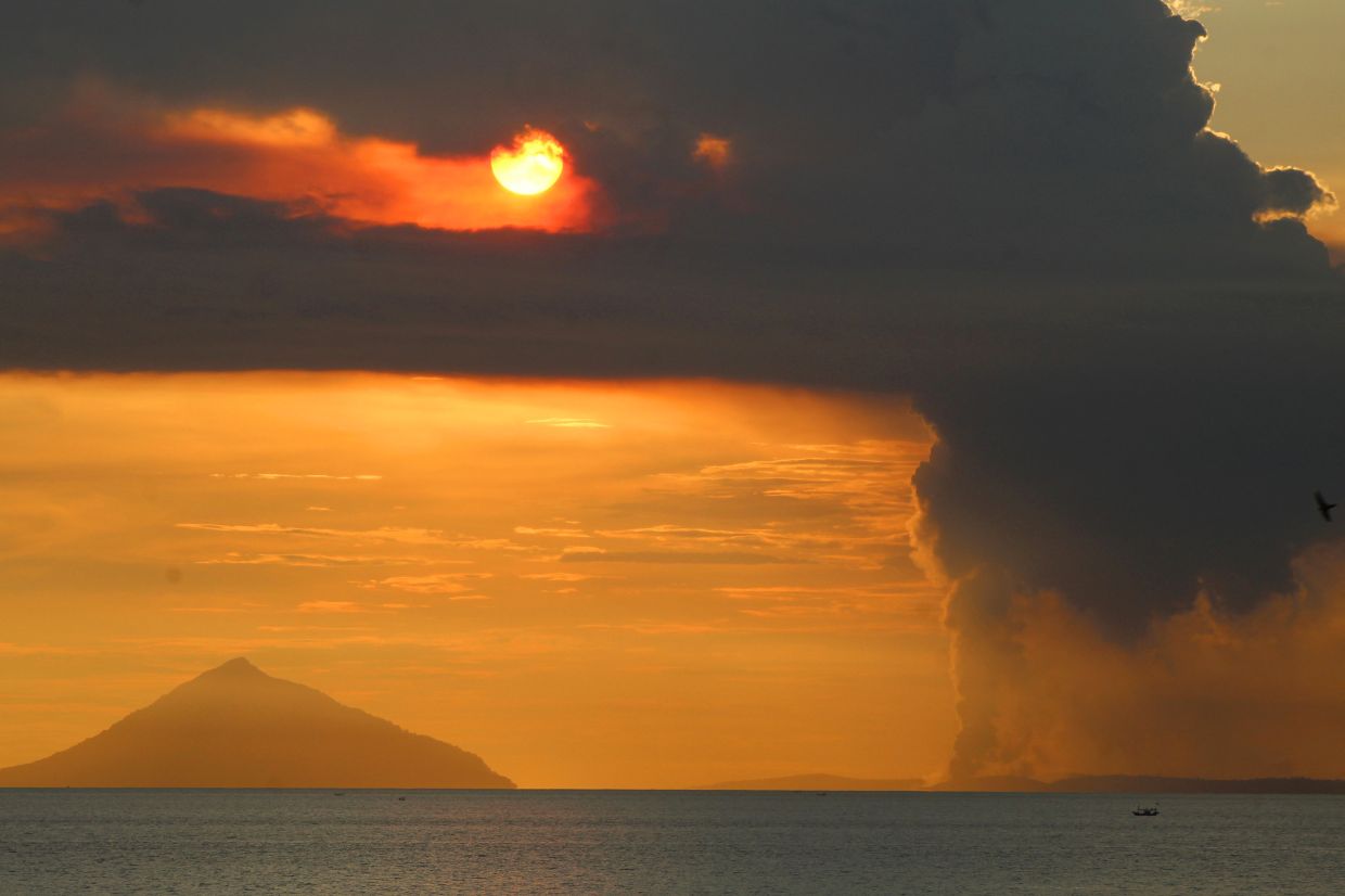
Mount Anak Krakatau, the volatile volcano rising from the Sunda Strait's waters, erupted on Tuesday, July 7, projecting a thick column of ash approximately 100 metres into the sky. The event marked the latest in an accelerating sequence of volcanic disturbances that have prompted Indonesia's geological authorities to escalate their warnings and restrict access to surrounding waters. Recorded at 8:21 a.m. by the Geological Agency of the Energy and Mineral Resources (ESDM), the eruption generated seismic signals with a maximum amplitude of 11 millimetres, lasting roughly 15 seconds, while observers documented a dense grey ash plume drifting towards the north-west from the crater.
The volcano's recent awakening represents a dramatic departure from prolonged quietude. Beginning in mid-June after an extended dormant period, Mount Anak Krakatau has transitioned into an increasingly restless state. The shift commenced around June 10, with seismic monitoring networks detecting a gradual rise in tremor activity. However, the genuine acceleration manifested between mid-to-late June, when daily earthquake and tremor events ballooned from initial counts of around 50 daily occurrences to sustained levels exceeding 97 events per 24-hour cycle by early July. This exponential escalation in underground seismic energy represents the kind of precursor pattern that typically signals transitioning magmatic systems.
Responding to the intensified activity, Indonesia's Geological Agency elevated Mount Anak Krakatau's alert classification from Level II (Alert) to Level III (Watch) on Friday, positioning it at the second-highest tier within the nation's four-category volcanic risk framework. Concurrently, authorities established a mandatory three-kilometre exclusion perimeter surrounding the volcano's crater region, effectively prohibiting civilian access to the immediate vicinity. Andi Suwardi, who directs the Mount Anak Krakatau Observation Post in South Lampung, characterised the current situation as one of fluctuating but sustained volcanic unrest, emphasising that round-the-clock monitoring teams maintain continuous surveillance tracking crucial parameters including ash column heights and underlying seismic behaviour.
Despite official restrictions and increasingly explicit safety warnings, economic pressures have driven some fishing communities and tourism entrepreneurs to persist in approaching dangerously close to the volcano. The three-kilometre safety buffer, while scientifically justified, represents a significant constraint on livelihoods for populations dependent on maritime harvests and volcano-tourism ventures. Regent Radityo Egi Pratama of South Lampung attempted to appeal to operators' self-interest and communal responsibility, acknowledging the genuine economic hardship created by restricted access while asserting that personal safety considerations must supersede short-term income generation. His statements reflect the broader tension throughout Indonesia's volcanically active regions between legitimate livelihood requirements and fundamental survival imperatives.
Mount Anak Krakatau's eruption history carries particular weight within the broader Indonesian and Southeast Asian consciousness. The volcano itself represents a geological child born from catastrophe—specifically, the monumentally destructive 1883 eruption of the original Mount Krakatau. That cataclysmic event remains among history's deadliest volcanic disasters, with estimates suggesting approximately 36,000 deaths across the region resulting from the combination of explosive forces and subsequent tsunami waves. The 1883 eruption ejected such prodigious quantities of particulate matter into the upper atmosphere that it measurably disrupted global weather patterns and influenced climate systems worldwide for months following the disaster. Mount Anak Krakatau, which emerged from the sea within the caldera left by that devastation in 1927, carries this historical burden.
The volcano's modern threat potential received tragic confirmation on December 22, 2018, when a partial flank collapse triggered a significant tsunami inundating coastal areas of southern Sumatra and western Banten. That single event killed at least 429 individuals and injured more than 7,200 others, demonstrating that Mount Anak Krakatau remains capable of inflicting substantial regional damage despite its relatively modest size compared to its ancestral predecessor. The 2018 disaster fundamentally reset public perception regarding the volcano's genuine hazard profile and vindicated monitoring authorities' consistent characterization of the region as genuinely dangerous territory.
The current escalation in seismic and eruptive activity carries implications extending beyond immediate safety considerations. For Malaysia's eastern peninsula and Singapore, volcanic systems within the Sunda Strait warrant close attention given their capacity to generate transnational consequences through tsunami propagation and, under extreme scenarios, atmospheric particulate dispersal. The densely populated Malaysian territories in Johor and the urban concentrations throughout Singapore represent regions with substantial populations and critical infrastructure that could theoretically experience disruptive effects from large-scale Krakatau-region volcanic events. While current activity levels remain substantially below the scale that would threaten such distant areas, the monitoring of Indonesian volcanic systems constitutes a legitimate regional security concern for all Straits of Malacca adjacent nations.
Observation post personnel have emphasized that the current alert level classification, despite its elevation to Level III, does not automatically forecast imminent catastrophic eruption. Rather, Level III designation signals that volcanic indicators show clear intensification warranting heightened surveillance, operational readiness among emergency response agencies, and public awareness regarding evolving hazard conditions. Andi Suwardi stressed that alert level determinations represent dynamic assessments subject to modification as conditions evolve, either improving or deteriorating. The distinction matters considerably for affected populations attempting to balance risk mitigation with economic survival, as Level III classifications can persist for extended periods without necessarily escalating to Level IV (Emergency)—the maximum alert threshold.
The timing of this volcanic reawakening intersects awkwardly with Indonesia's monsoon season and maritime activity patterns. Waters surrounding Mount Anak Krakatau experience peak fishing pressure and tourism traffic during periods when weather patterns prove most favourable for ocean navigation. The establishment of exclusion zones precisely when economic activity peaks creates acute pressure on monitoring authorities to maintain consistent enforcement while sympathizing with the genuine hardship imposed on maritime-dependent communities. Government officials have acknowledged these tensions while maintaining that immediate safety considerations must govern operational decisions, but the ongoing detection of vessels and operators within restricted zones indicates that economic desperation frequently overrides official guidance.
Looking forward, the evolution of Mount Anak Krakatau's behaviour over coming weeks will prove decisive in shaping both public safety outcomes and economic recovery trajectories for affected communities. Should seismic activity stabilize and eruptive events diminish in frequency and magnitude, authorities could potentially lower alert classifications within weeks, rapidly restoring livelihood opportunities. Conversely, further acceleration in underground energy release could necessitate maintaining or even escalating restrictions, prolonging economic disruption indefinitely. The tension between these scenarios underscores why volcanic monitoring in densely populated regions constitutes such a delicate balance between scientific precision, public communication, and socioeconomic realities that inevitably shape how populations respond to official warnings regarding invisible geological forces.

