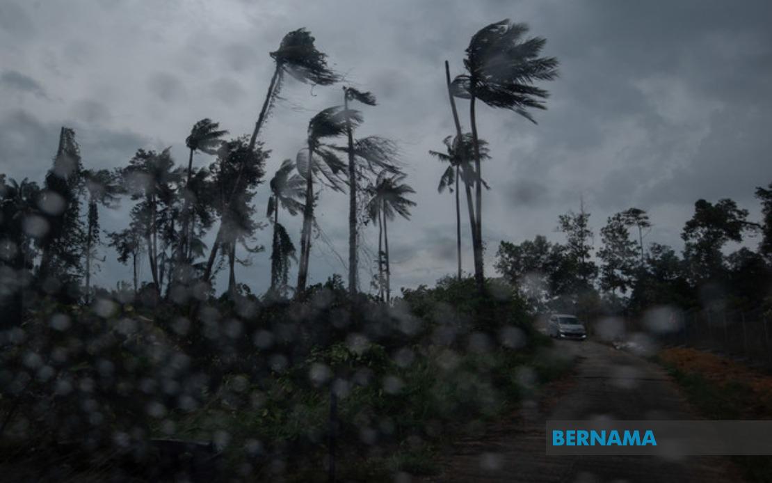
The Malaysian Meteorological Department issued an urgent weather alert at 8.35 am on August 16 warning of thunderstorms, heavy rain and strong winds expected to sweep across significant portions of Peninsular Malaysia and Sarawak until 1pm. The short-term advisory, which remains valid for a maximum of six hours per bulletin, signals rapidly developing atmospheric conditions that residents and motorists should monitor closely throughout the morning hours.
The warning encompasses the entirety of Perlis and Melaka states, underscoring the broad geographical scope of the expected weather system. Within Kedah, three key districts face impact: Langkawi, the island tourism destination; Kubang Pasu; and Kota Setar, the state capital. This coverage pattern suggests a moisture-laden weather front moving across the northern peninsula with sufficient intensity to warrant widespread precautions across multiple administrative zones.
In Pahang, the alert specifically names Kuantan, the state capital and major population centre, alongside Pekan and Jerantut. The inclusion of these diverse areas—ranging from coastal to inland locations—indicates the pervasive nature of the weather system. Selangor faces warnings for Sepang and Kuala Langat, both strategically important regions given their proximity to the Klang Valley and major transport corridors. The inclusion of Sepang, home to the Kuala Lumpur International Airport and industrial zones, carries particular significance for logistics and air operations during the warning period.
Negeri Sembilan residents in Port Dickson, Seremban, Rembau, Kuala Pilah and Tampin are advised to prepare for adverse conditions. This five-district coverage reflects the system's impact across the state's geography, from its coastal western reaches to interior highlands. Johor's warning zone encompasses Tangkak and Muar, positioning the alert in the state's central-western corridor. Together, these affected areas represent a substantial portion of Malaysia's population and economic activity, from major manufacturing hubs to important agricultural regions.
Sarawak's east Malaysia territory faces similar threats, with nine districts or areas specifically mentioned: Mukah, Selangau, Sibu, Sarikei, Maradong, Bintulu, Kapit, Bukit Mabong and Subis in Miri. The extensive coverage across Sarawak suggests that the weather disturbance extends well beyond Peninsula boundaries, potentially indicating a more expansive tropical system affecting the broader region. Sibu, as Sarawak's commercial hub, represents a critical node for the state's economic activity and transportation networks.
The nature of the warnings—thunderstorms combined with heavy rainfall and strong winds—poses multiple hazards to residents and infrastructure. Thunderstorm activity can generate lightning strikes, posing risks to individuals outdoors and to electrical systems. Heavy rainfall accumulated over a short period increases flood risks, particularly in low-lying areas, near river systems, and in districts with historical flooding vulnerabilities. Strong winds accompanying such systems can damage structures, dislodge roofing materials, and create hazards for vehicles on highways.
MetMalaysia's classification of this as a short-term warning, valid for six-hour periods, reflects the dynamic nature of weather prediction in the tropics. Such brevity indicates that forecasters are tracking a system with relatively rapid movement or evolving characteristics. Residents and authorities should expect updated advisories as the situation develops, with the 1pm cutoff suggesting forecasters expect conditions to stabilise or the system to move beyond the affected zones by early afternoon. This time frame is typical for tropical thunderstorm systems, which often develop and dissipate within relatively short windows.
For commuters and transport operators, the warning carries immediate operational implications. Morning traffic during peak hours may face disruptions from reduced visibility, road surface water, and increased accident risks. Public transport operators and emergency services should heighten readiness for weather-related incidents. Schools and workplaces located in affected zones should assess whether additional precautions are warranted, though the mid-morning timeframe suggests that most educational and commercial activities will proceed with heightened awareness.
Agricultural sectors across the affected states should note that while rainfall benefits crop irrigation during dry periods, thunderstorm-intensity precipitation can cause soil erosion, crop damage through wind effects, and livestock stress. Plantation owners and smallholders should ensure drainage systems function adequately and livestock are appropriately sheltered. The warning also carries implications for construction sites, which may experience work delays or safety interruptions during the heaviest precipitation.
For residents in coastal areas like Port Dickson, Muar, and Sarawak's riverine communities, MetMalaysia's alert warrants particular attention to localised flooding risks. Storm surge potential during concurrent high-tide periods, though not explicitly mentioned in the weather alert, remains a secondary consideration for low-lying coastal zones. Boat operators and maritime transport should exercise caution, as strong winds and heavy rain reduce visibility and create challenging sea conditions.
The geographical distribution of alerts across multiple states reflects the monsoon season's influence on Malaysian weather patterns. August typically falls within the Southwest Monsoon period, which can generate such weather disturbances as moisture-laden air masses interact with the peninsula's topography. Understanding this seasonal context helps residents anticipate that additional similar alerts may occur throughout the remainder of the month as atmospheric conditions remain conducive to thunderstorm development.
Authorities across affected states have received this advisory with sufficient lead time to issue local warnings and activate emergency preparedness protocols where necessary. Municipal councils, disaster management committees, and public safety agencies typically respond to MetMalaysia alerts by increasing field patrols, preparing emergency resources, and ensuring rapid response capabilities for weather-related incidents. The public, in turn, should remain alert to official channels for any updates and exercise prudence in outdoor activities, travel decisions, and property security during the warning period.

