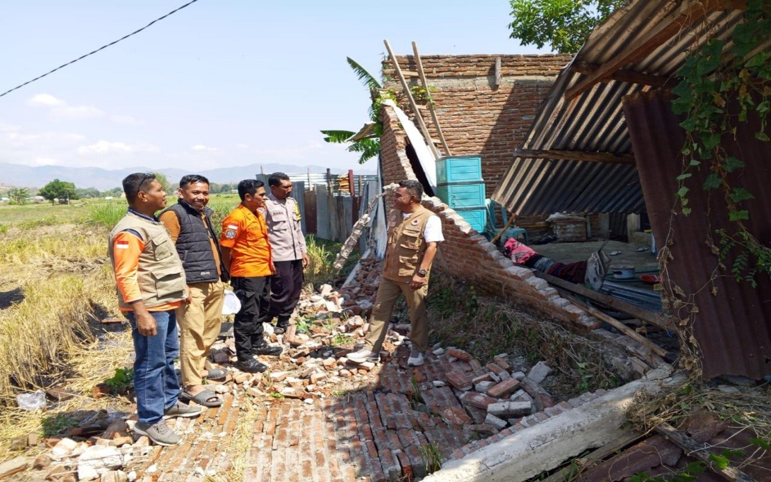
A powerful magnitude 7.7 earthquake rocked Indonesia's Flores Island in East Nusa Tenggara province early Saturday morning, leaving at least 38 people dead and setting off an urgent race against time for rescue operations. The National Disaster Management Agency (BNPB) confirmed the grim toll as search and rescue teams fanned out across the affected region, where many residents remain trapped under the rubble of collapsed buildings and blocked access routes.
The seismic event struck at 4.58 am local time with its epicentre approximately 30 kilometres offshore from Mbay at a shallow depth of 15 kilometres, conditions that typically amplify the destructive impact on populated coastal areas. The shallow epicentre and magnitude combination generated sufficient force to trigger widespread structural damage across the island's communities. Authorities initially issued a tsunami warning, though observations of sea-level patterns led officials to lift the alert by 7.31 am, preventing additional panic among already traumatised residents.
According to BNPB chief Suharyanto, the disaster picture remains fluid as the first day of recovery operations unfolded. By mid-afternoon Saturday, two individuals had sustained serious injuries while 11 others suffered minor wounds. The agency documented approximately 2,000 residents who had already self-evacuated from the most severely impacted zones, though officials emphasised that many more inhabitants still require urgent assistance. Suharyanto cautioned that casualty figures and damage assessments would continue evolving as rescue teams accessed previously unreachable areas and conducted more thorough surveys of affected communities.
The physical destruction extends well beyond residential dwellings. Multiple community health centres, which serve as critical infrastructure for remote island populations, suffered significant damage that will hamper medical response capabilities during this crisis period. Several roads became impassable due to landslides triggered by the earthquake's ground movement, creating serious obstacles for rescue vehicles attempting to reach isolated pockets of survivors. The damage to airport terminal facilities and port infrastructure compounds these access challenges, though the runway itself remained operational, preserving at least one crucial logistics lifeline.
Recognising the time-sensitive nature of rescue operations, the Indonesian government mobilised an extensive emergency response apparatus. Personnel from the National Search and Rescue Agency (Basarnas), Indonesian military units, and police forces deployed across the island with specialised equipment and trained personnel. The government's approach prioritised immediate rescue operations while simultaneously beginning the complex work of restoring critical transport and communication systems. The Public Works Ministry dispatched teams equipped with heavy machinery to clear landslide-blocked roads, understanding that every hour of delay potentially costs lives.
Airborne resources have proven essential given the terrain challenges and road blockages. BNPB deployed two helicopters and a fixed-wing aircraft specifically to support evacuation efforts and deliver humanitarian supplies to communities cut off from ground access. These aircraft enable authorities to reach high-priority survivors and transport them to medical facilities while also establishing supply chains for food, drinking water, clean water for sanitation purposes, temporary shelter tents, generators, and other survival essentials. The dual-purpose operations underscore the coordination required when natural disasters strike remote island regions with limited infrastructure redundancy.
For Malaysia and neighbouring Southeast Asian nations, this disaster underscores the region's vulnerability to seismic activity. The Flores region sits along the Pacific Ring of Fire, a zone of intense geological activity where tectonic plate interactions frequently produce powerful earthquakes. Indonesia's position as an archipelago spanning multiple tectonic zones means such events occur with concerning regularity, yet each earthquake presents unique challenges based on population density, building standards, and emergency response capacity. Malaysian observers should note how quickly rescue coordination and air transport become critical when road access fails—lessons directly applicable to Malaysia's own mountainous and island regions.
The earthquake's timing on a Saturday morning, while reducing workplace casualties, meant residents were more likely to be indoors and in residential structures that often lack the engineering standards of commercial buildings. This demographic distribution of risk—combined with the island's remote location and limited pre-existing medical capacity—creates a compounding vulnerability that particularly affects poorer and more isolated communities. The psychological and economic trauma extending beyond the immediate death toll will persist for months as survivors cope with injuries, displacement, and reconstruction needs that will strain local resources.
Indonesia's emergency management agencies have learned from previous major earthquakes and tsunamis, and the rapid deployment of Basarnas, military, and police assets reflects institutional memory of effective response protocols. However, the ongoing nature of recovery operations, the need to assess damage across dispersed communities, and the challenge of reaching survivors in collapsed structures means the critical phase will extend well beyond Saturday. For Malaysia's perspective, this event reinforces the importance of maintaining robust disaster preparedness frameworks, regular disaster simulation exercises, and pre-positioned emergency supplies—factors that become decisive when earthquakes strike without warning.

