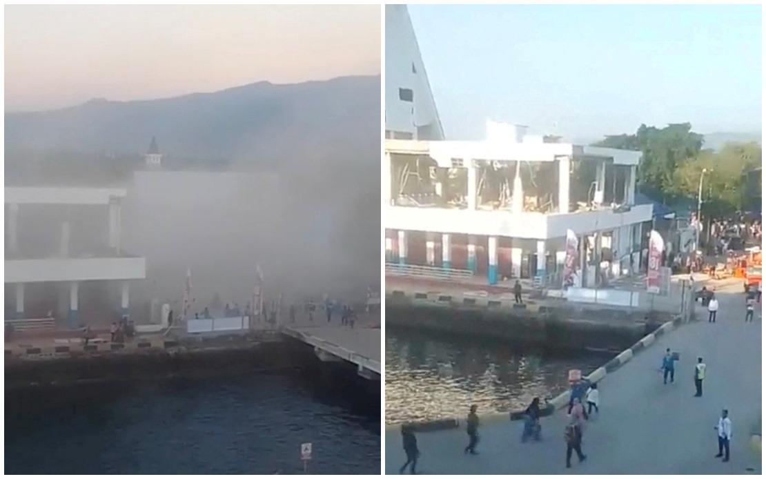
Eastern Indonesia experienced devastating seismic activity on Saturday when a magnitude 7.7 earthquake struck off the coast of Flores Island, leaving a significant death toll in its wake. The tremor, which centred near Mbay town in Nagekeo Regency, has claimed at least 20 lives according to officials at the Maumere Search and Rescue Office, with six others sustaining injuries and two people still missing beneath collapsed structures. The disaster represents one of the more severe seismic events to impact the region in recent months, underscoring the constant geological vulnerability of Indonesia's eastern provinces.
The earthquake unleashed considerable destruction across affected areas, with widespread reports of collapsed buildings and extensive residential damage throughout East Nusa Tenggara province. Structural failures were evident in footage circulating on social media, which captured the moment buildings crumbled into dust and debris as terrified residents fled into streets seeking safety. Beyond the immediate structural casualties, the seismic activity triggered landslides that have blocked and severed critical road infrastructure, hampering both rescue operations and the movement of emergency supplies into affected communities. Provincial governor Melki Laka Lena acknowledged during a press briefing in Kupang that comprehensive damage assessment work was still ongoing, suggesting the full extent of destruction may yet exceed initial reports.
The sequence of geological events that unfolded began with the primary shock but continued through numerous powerful aftershocks that kept residents on heightened alert. Indonesia's Meteorology, Climatology and Geophysics Agency initially issued a tsunami warning following the earthquake, though this alert was subsequently lifted as water level monitoring showed no dangerous wave activity. However, officials have maintained advisories urging continued vigilance against potential subsequent tremors, as aftershock sequences in the region can persist for extended periods and occasionally produce considerable secondary damage.
The immediate impact extended to regional transportation networks, with multiple commercial flights to East Nusa Tenggara province suspended as a precautionary measure. The disruption of air connectivity underscores how natural disasters in Indonesia's eastern zones can rapidly affect broader regional logistics and economic activity. For tourists and residents alike, the grounded flights created stranded situations that highlighted the vulnerability of island communities when geological hazards strike.
International authorities moved quickly to issue safety guidance for their nationals in the affected region. The Chinese Consulate General in Denpasar released an advisory on Saturday morning targeting Chinese citizens within its consular jurisdiction, particularly those visiting the popular tourist destination of Labuan Bajo. The consulate specifically cautioned visitors to avoid coastal areas and maintain constant awareness of official disaster warnings, recognising that foreign tourists may be less familiar with Indonesia's earthquake protocols and coastal evacuation procedures. This guidance reflected broader international concern for nationals present in active geological zones.
The earthquake's location near Mbay places the disaster within a region historically prone to significant seismic activity. Flores Island sits within the Pacific Ring of Fire, a zone of intense tectonic activity spanning the Indo-Pacific region where the convergence of multiple major and minor tectonic plates creates conditions for frequent and powerful earthquakes. Understanding this geological context is essential for appreciation of why communities in eastern Indonesia face recurring natural disaster cycles that demand constant preparation and resilience-building efforts from both government authorities and civilian populations.
For Malaysia and other Southeast Asian neighbours, the Flores Island earthquake serves as a sobering reminder of the region's ongoing seismic susceptibility and the importance of maintaining robust disaster preparedness frameworks. While Malaysia itself experiences considerably lower earthquake frequencies compared to Indonesia's eastern zones, the proximity of neighbouring countries means transnational disaster response capabilities and information-sharing mechanisms remain vital components of regional stability. The incident underscores how natural disasters in one country can have ripple effects across the broader Southeast Asian community through disrupted tourism, trade, and transportation networks.
Emergency response operations were actively proceeding as authorities worked to compile comprehensive casualty data and assess damage across all affected municipalities. Rescue teams deployed to affected areas faced challenging conditions created by landslides and damaged infrastructure, which complicated access to some impacted communities and slowed the pace of recovery operations. The ongoing nature of casualty reporting suggested that final death tolls might shift as search and rescue efforts progressed and as fuller damage assessments became available from more remote affected locations.
The disaster highlights persistent challenges facing Indonesia's eastern provinces in managing natural hazard risks despite considerable institutional experience with earthquake disasters. Improving building construction standards, enhancing early warning systems, and ensuring rapid resource deployment to affected areas represent ongoing priorities for emergency management authorities. For communities in earthquake-prone regions, the balance between accepting inherent geological risks and implementing practical disaster mitigation measures remains an ongoing concern requiring sustained attention and investment.

