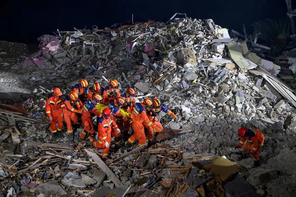
Rescue workers deployed controlled explosives on Monday to fragment a massive boulder obstructing the search for 34 people unaccounted for after a landslide devastated a southwestern Chinese county over the weekend. The disaster struck during torrential downpours in Penghui county, located approximately 270 kilometres from Chongqing's urban core, killing at least eight people and forcing authorities to evacuate more than 1,100 residents from the affected region of roughly 500,000 inhabitants.
State media footage captured the dramatic moment explosives shattered the imposing rock formation, symbolizing the intensification of what rescue officials characterised as entering a "deep rescue phase" in their efforts to locate survivors. The operation represents a critical juncture in the search, as the missing have now been unaccounted for following Friday's disaster. The geographical challenges facing rescuers are formidable: the county sits in terrain where communities perch precariously on steep hillsides flanking the Wujian river, with the collapsed mountainside partially cascading into the waterway and severing the main thoroughfare of the hillside township.
The catastrophe prompted swift directives from China's top leadership. President Xi Jinping issued instructions emphasising the importance of methodical, scientifically-informed rescue protocols and called for rapid investigation into the underlying causes of the disaster. These directives underscore the gravity with which Beijing views such incidents and the political imperative to demonstrate competent crisis response and accountability mechanisms.
China's vulnerability to landslides reflects both geographical and developmental realities. The nation ranks among the world's most landslide-prone countries, a distinction rooted in its topography, where mountains, hills, and plateaus comprise roughly two-thirds of the national landmass. This terrain becomes particularly hazardous during seasonal rainfall patterns, and the past decade alone has witnessed approximately 294 fatalities across at least five major landslide incidents nationwide. The most devastating on record occurred in December 2015 when the collapse of a colossal mound of construction debris at an industrial facility in the southern technology centre of Shenzhen claimed more than 70 lives.
The convergence of natural and human factors has intensified disaster risk across China's vulnerable regions. Intense summer monsoon rainfall combines with rapid urbanisation and aggressive construction practices to destabilise hillside communities. Compounding these pressures, the nation's geological complexity means frequent tectonic activity further weakens the structural integrity of slopes already saturated by abundant groundwater. Authorities have dispatched teams to investigate concealed geological hazards and monitor for potential secondary disasters—such as additional landslides or flooding—that frequently accompany the initial event.
Meteorological forecasts have heightened concerns across multiple provinces. Predictions of sustained heavy to torrential precipitation extending through Monday prompted authorities to intensify safeguard measures in high-risk zones. Official announcements highlighted the particular vulnerability of regions characterised by excessive groundwater and intensive construction activity. These conditions create a multiplier effect: saturated soil loses structural cohesion whilst heavy development loads compress and destabilise natural slopes.
The immediate hydrological situation underscores the cascading nature of such disasters. State broadcaster CCTV reported that eight smaller to medium-sized rivers across Yunnan, Guangxi, Guangdong, Anhui, and Shanghai were flowing above flood warning thresholds as of Monday, indicating that the weather systems triggering the Penghui landslide extended across a broader swath of eastern and southwestern China. This geographic spread suggests the potential for multiple simultaneous disaster scenarios during the wet season.
For Malaysia and Southeast Asia, China's landslide patterns offer cautionary lessons about managing rapid urbanisation in mountainous terrain. The region shares comparable geological characteristics, with numerous locations experiencing seasonal monsoon intensity and escalating construction pressures. Countries including Malaysia, with its own steep topography and monsoon-driven rainfall, face similar compounding risk factors where inadequately planned hillside development intersects with intense precipitation cycles.
The Penghui incident exemplifies how natural hazards become disasters through the accumulation of risk factors rather than the occurrence of any single event. Strategic land-use planning, geological hazard mapping, construction standards enforcement, and early-warning systems represent essential components of disaster mitigation. China's response—emphasising scientific rescue protocols and hazard investigation—reflects recognition that reactive rescue operations, however dramatic and well-resourced, ultimately represent failure of prevention and preparedness systems.

