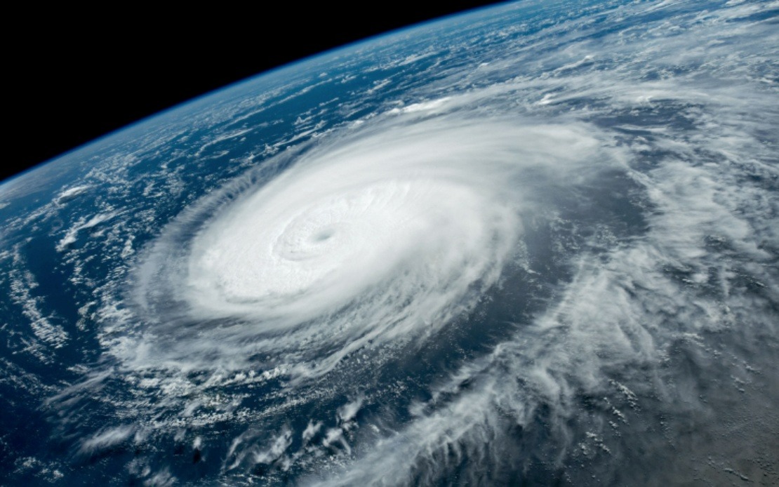
Coastal provinces across eastern China are mobilizing an extensive emergency response as Typhoon Dolphin barrels toward landfall, with authorities implementing precautionary measures ranging from mass vessel recalls to large-scale evacuations. The approaching storm has triggered significant disruptions to transportation and commercial operations, signalling the severity of the threat that meteorological officials expect the system to deliver once it reaches the mainland.
China's meteorological authority escalated the storm to Level III emergency response status on Saturday, simultaneously raising the typhoon warning classification from yellow to orange on the national four-tier alert system. This dual escalation reflects growing confidence among forecasters that Dolphin will make a significant impact on populated coastal regions. The storm is anticipated to make landfall somewhere along the coastline stretching between Zhoushan in Zhejiang Province and Fuding in Fujian Province, with the most critical window occurring from Sunday night through Monday morning.
Zhejiang Province, which sits directly in the storm's projected path, has responded with characteristic intensity by raising its own typhoon emergency response to the second-highest level. The province has deployed more than 4,000 dedicated monitors tasked with inspecting over 7,500 designated high-risk zones where landslides and other geological disasters pose secondary threats to communities. This pre-emptive monitoring strategy aims to provide early warning should the typhoon trigger terrain instability in vulnerable mountain and hillside areas.
Transportation infrastructure throughout Zhejiang has effectively come to a standstill in preparation for the typhoon's arrival. All 162 passenger ferry routes operated within the province have been suspended, eliminating a critical transportation artery for residents and commerce. The halt extends beyond civilian ferries: authorities have halted operations at all 193 offshore construction projects and compelled 474 construction vessels to return to port by Friday morning. Such comprehensive cessation of maritime activity reveals the breadth of disruption authorities anticipate.
Fujian Province, positioned as the secondary threat zone, has implemented its own coordinated response measures. Maritime authorities there suspended 40 passenger ferry routes and halted work at 115 offshore construction sites by Saturday noon. In Fuding, the coastal city that represents the southern boundary of the landfall zone, all 1,210 registered fishing boats had returned to port, effectively clearing the waters of commercial vessels that might otherwise be caught in the storm's path.
Shanghai, lying to the north of the primary landfall zone but still vulnerable to typhoon systems, issued a blue-level typhoon alert on Friday as meteorologists warned the city could experience strong winds and heavy precipitation persisting for up to four days. This extended impact window suggests the storm may stall or move slowly once inland, prolonging rather than concentrating the weather impact. Train services throughout the Yangtze River Delta region, which encompasses Shanghai and surrounding areas, face suspension beginning Sunday as the transportation network prepares for the typhoon's effects.
Meteorologists have drawn explicit comparisons between Typhoon Dolphin and Typhoon Bavi, which made landfall in China during July. Xu Yinglong, the chief forecaster at the National Meteorological Centre, characterized Dolphin as potentially more severe, warning that it may deliver stronger wind speeds and heavier rainfall totals than its predecessor. Such assessments carry weight given Bavi's own significant impact on the country just weeks earlier, suggesting the region faces a meaningful escalation in typhoon intensity.
China's formal alert systems, which classify both weather conditions and emergency responses on distinct four-tier scales, provide a standardized framework for coordinating response efforts across provincial and municipal boundaries. The weather warning system ranks typhoons by severity using a colour scheme where red denotes the most dangerous conditions, orange indicates major concern, yellow signals moderate threat, and blue represents the least severe classification. Simultaneously, the emergency response system operates with Level I representing the highest activation state, descending through progressively lower levels of readiness.
The advancement to Level III emergency response, two steps below the maximum activation threshold, indicates authorities judge the situation serious enough to warrant substantial disruption but not yet catastrophic. This calibrated response reflects the balance between protecting public safety and managing the economic costs of widespread shutdowns. For Malaysian readers following developments in the region, Typhoon Dolphin represents the type of major weather system that periodically affects Southeast Asia, underscoring the shared vulnerability of tropical and subtropical regions to such natural phenomena.
The comprehensive preparatory actions undertaken across Zhejiang and Fujian—involving thousands of personnel, thousands of vessels, and hundreds of construction sites—demonstrate the operational capacity required to manage major typhoons in densely populated areas. These same response frameworks remain relevant to maritime nations throughout Southeast Asia, including Malaysia, where similar typhoon systems occasionally threaten coastal populations and offshore infrastructure. The coordination demonstrated by Chinese authorities across multiple provinces offers comparative insight into how large-scale coordinated disaster preparation functions across political boundaries.

