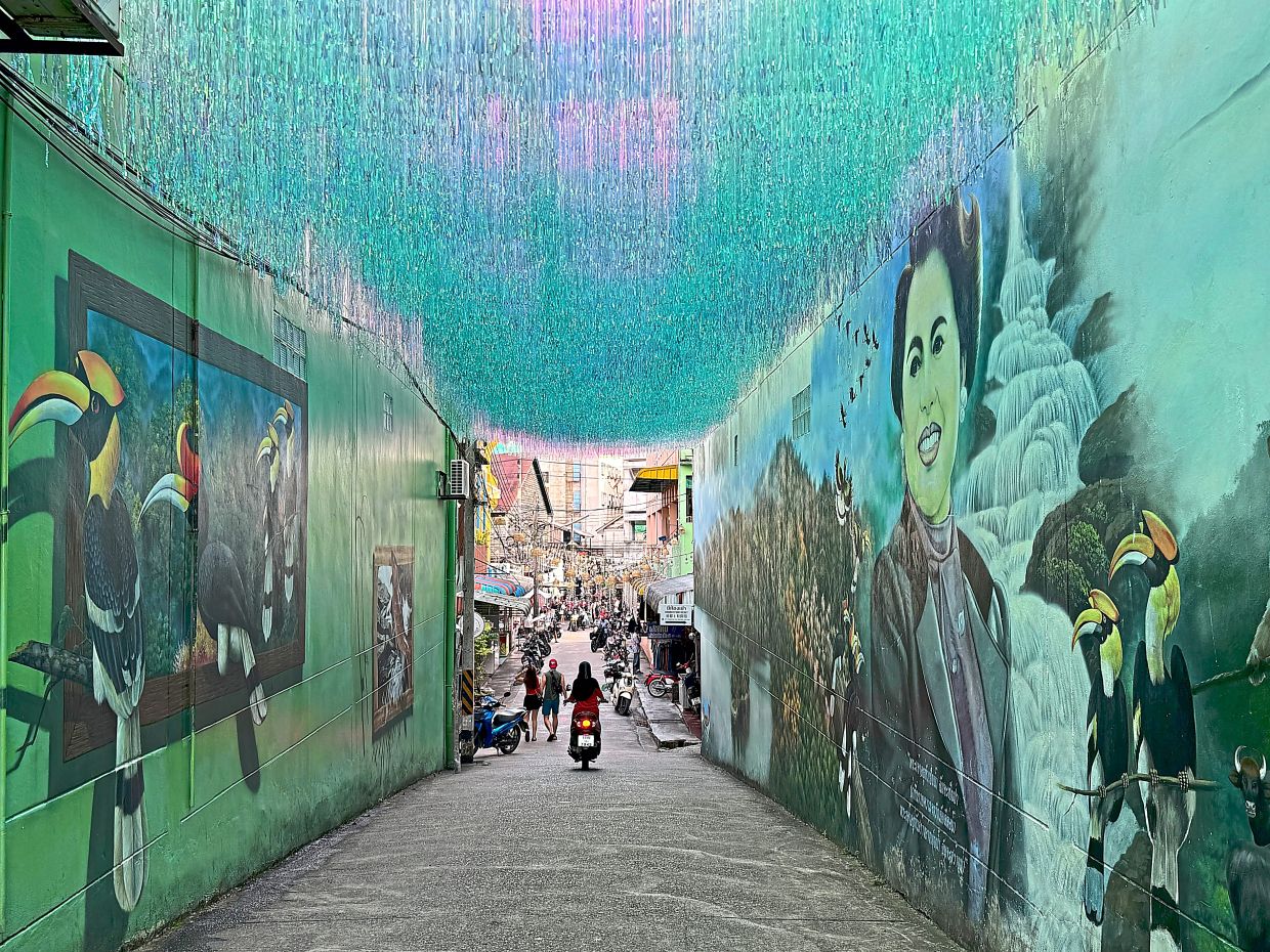
A five-hour drive from Kuala Lumpur brings Malaysian road travellers to Betong, a modest Thai town that belies its collection of distinctive attractions and historical significance. Located approximately 380 kilometres north and accessible via the Malaysian-Thai border, Betong has quietly emerged as a compelling waypoint for cross-border visitors seeking experiences beyond conventional tourism. What initially appears as a quiet provincial settlement gradually reveals itself as a place where local pride, historical narrative, and creative urban identity converge in unexpected ways.
The town's most visible symbol is the Betong chicken, a local breed that has become emblematic of regional identity and cuisine. Giant statues honouring this chicken breed serve as the town's unofficial welcome, prompting curiosity among first-time visitors unfamiliar with their significance. The chicken's elevated status extends throughout Betong's food culture, where variations appear across restaurant menus—from conventional chicken rice to more unconventional chicken porridge. The celebration reflects how Southeast Asian communities often transform agricultural heritage into cultural markers, creating identity through culinary tradition and visual symbolism that attracts both domestic and foreign tourists.
Beyond culinary attractions, Betong's infrastructure itself tells stories of regional development and Cold War history. The Mongkollit Tunnel, constructed in 2001 and officially recognised by the Tourism Authority of Thailand as the country's first mountain tunnel, initially seems unremarkable during daylight hours. However, evening transformation through carefully designed blue illumination converts the engineering achievement into a spectacle, with visitor pathways lined with photographers and sightseers. This thoughtful repurposing of infrastructure for tourism demonstrates how Thai authorities have recognised opportunities to monetise practical developments whilst creating photo-worthy experiences that circulate through social media platforms.
The more historically resonant attraction lies in the Piyamit Tunnel, located fifteen kilometres from town. Constructed during the late 1970s, this one-kilometre passage formerly functioned as a Communist Party of Malaya base, serving simultaneously as air raid shelter, storage facility, and escape route during military operations. The tunnel's original design featured multiple entrances and exits positioned throughout surrounding jungle, enabling guerrilla fighters to disperse in various directions during attacks. Several access points have since been sealed for safety considerations, yet the remaining accessible sections preserve the physical geography of Cold War insurgency in mainland Southeast Asia.
Visiting the Piyamit Tunnel requires navigation through approximately fifteen minutes of covered pathway before reaching the entrance. The visitor centre facilitates access whilst the on-site Piyamit Histories Museum documents the daily existence of communist fighters through historical photographs and artefacts. The museum experience contextualises what visitors subsequently encounter—sleeping quarters, meeting rooms, and communications facilities carved into rock—transforming what might otherwise appear as abstract tunnel spaces into habitable environments where political struggle materialised through quotidian reality. Outside, an ingeniously designed cooking area with smoke-channelling mechanisms reveals how combatants concealed their presence through environmental manipulation.
For those seeking deeper engagement with this historical chapter, the Chulabhorn Phatthana Village 9 in Mae Wat, located approximately 120 kilometres distant, offers continuation of the narrative. Originally inhabited by former communist party members following the insurgency's conclusion, the village has evolved into a cultural heritage site where visitors encounter post-conflict reconciliation and reintegration narratives. This geographical and interpretive progression allows travellers to understand not merely the conflict itself but the decades-long process through which former combatants transitioned into civilian society.
Betong's walkability distinguishes it from many Thai provincial towns, particularly for visitors based in the older central district where primary attractions cluster within reasonable pedestrian distance. The town's compact geography contrasts with driving difficulties and scarce parking availability, creating conditions that paradoxically favour foot-based exploration. Local parking conventions—indicated by black-and-white kerbing permitting parking, versus red-and-white prohibition—require familiarity that travellers gradually acquire through observation or local assistance.
The Pattani-Betong Highway, designated Route 410, represents another distinctive feature attracting specialist visitors, particularly motorcycle enthusiasts. Stretching approximately 160 kilometres through mountainous terrain with steep gradients and serpentine curves, the scenic route has cultivated dedicated biker communities. Specialist shops catering to this demographic, such as Betong Route 410, market lifestyle merchandise ranging from apparel to customised number plates, reflecting how subcultures generate economic activity and social clustering around specific geographic features.
Near this recreational corridor sits Wat Phutiwhat (also rendered as Wat Phuttha Thiwat), where an imposing bronze Buddha statue positioned at the temple entrance commands views across the town. The temple houses Buddha relics and functions as both religious site and tourist destination, though optimal visitation timing during early morning hours minimises crowding and accommodates the site's sacred function alongside secular tourism.
Betong's collection of oversized mailboxes adds another layer to the town's distinctive character. The original structure, standing 3.2 metres tall and dating to 1924, occupies a position near the Betong Clock Tower. This mailbox originally incorporated a government loudspeaker system for public announcements, combining communication infrastructure with postal function. Despite its historical designation, the mailbox remains operationally functional for mail services. A more recent 9-metre tall replica constructed as explicit tourist attraction stands outside the City Convention Hall along Sukyang Road, representing how communities recognise and amplify eccentric elements as visitor drawcards.
These accumulating attractions—the chicken symbolism, the illuminated tunnel infrastructure, the historical excavation of insurgency, the motorcycle culture, the religious monuments, and the deliberately enlarged postal infrastructure—collectively suggest that Betong succeeds not through singular marquee attraction but through dense clustering of accessible peculiarity. For Malaysian travellers accustomed to Peninsular experiences, Betong offers proximity without repetition, historical depth without mainstream tourist saturation, and sufficient strangeness to justify the five-hour journey.
The town exemplifies how secondary Southeast Asian destinations increasingly differentiate themselves through creative combination of heritage interpretation, infrastructure aesthetics, and deliberate celebration of local idiosyncrasy. Travellers arriving without predetermined itineraries often discover that Betong's surprises accumulate through unplanned exploration, suggesting that the destination's appeal derives less from any singular transformative experience than from sustained accumulation of modest discoveries that collectively distinguish the place from generic provincial Thailand.

